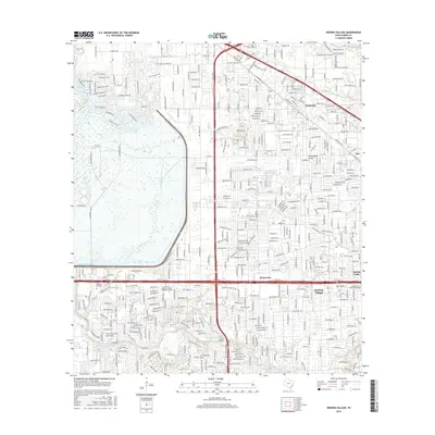
2016 Map of Hedwig Village
USGS Topo · Published 2016About this map
Buffalo Bayou and its winding tributaries, including Rummel Cr and Horseshoe Slough, anchor the southern half of this landscape, where the residential enclaves of Hedwig Village and Spring Valley are established. To the west, the massive drainage footprint of the Addicks Reservoir and Turkey Cr contrasts with the dense suburban grid of the Houston area. This 2016 survey captures a significant mix of educational and technical facilities, such as the Univ of Phoenix-Houston Westside Campus and the Institute of Ocean Technology, situated amidst established communities. Historical landmarks like the Memorial Oaks Cem and the settlement at Fairbanks sit alongside modern transportation corridors like the Katy Fwy and Hempstead Rd, illustrating the continued urban evolution of Harris County.
Find a feature on this map
24 named features on this map. Tap any name to fly to it.
Don’t see what you’re looking for? This feature index may not catch every label — zoom into the map to look around manually.
Map Details
Editions of this 2016 Hedwig Village Map
This is the sole edition of this map. No revisions or reprints were ever made.
Other maps of this area

1915 · Bellaire
USGS Topo · 1:24,000

1915 · Houston Heights
USGS Topo · 1:24,000

1915 · Alief
USGS Topo · 1:24,000

1915 · Cypress
USGS Topo · 1:24,000

1915 · Addicks
USGS Topo · 1:24,000

1915 · Hillendahl
USGS Topo · 1:24,000

1915 · Clodine
USGS Topo · 1:24,000

1916 · Aldine
USGS Topo · 1:24,000

1916 · Satsuma
USGS Topo · 1:24,000

1918 · Cypress
USGS Topo · 1:31,680
Featured Places
- Houston, TX
- Jersey Village, TX
- Hunters Creek Village, TX
- Bunker Hill Village, TX
- Spring Valley Village, TX