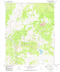
1979 Map of Heenan Lake
USGS Topo · Published 1982About this map
Mining operations and high Sierra terrain dominate this 1970s survey of the California-Nevada borderlands. The industrial impact is most visible at the Leviathan Mine and the nearby Leviathan Mine Ruins, where Tailings are clearly marked along the drainage of Leviathan Creek. Further south, the map documents a cluster of historical workings including the Zaca Mine, Globe Mine, and Red Gap Mine situated near the Monitor Creek drainage, illustrating the intensity of mineral exploration in this corner of the Toiyabe National Forest.
Find a feature on this map
52 named features on this map. Tap any name to fly to it.
Don’t see what you’re looking for? This feature index may not catch every label — zoom into the map to look around manually.
Map Details
Editions of this 1979 Heenan Lake Map
3 editions found
Other maps of this area

1889 · Markleeville
USGS Topo · 1:125,000

1891 · Markleeville
USGS Topo · 1:125,000

1893 · Markleeville
USGS Topo · 1:125,000

1948 · Walker Lake
USGS Topo · 1:250,000

1956 · Freel Peak
USGS Topo · 1:62,500

1956 · Topaz Lake
USGS Topo · 1:62,500

1956 · Markleeville
USGS Topo · 1:62,500

1957 · Walker Lake
USGS Topo · 1:250,000
1957 · Mt. Siegel
USGS Topo · 1:62,500

1962 · Walker Lake
USGS Topo · 1:250,000