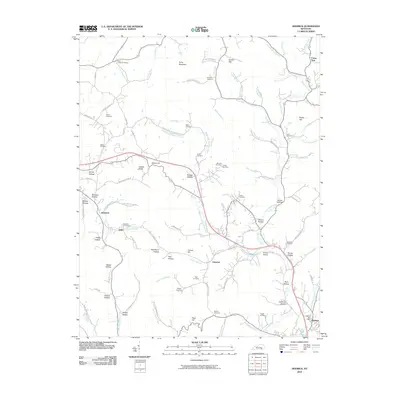
2010 Map of Heidrick
USGS Topo · Published 2010About this map
Richland Creek and its many winding tributaries, including Middle Fork Richland Creek, define the topography of this Knox County region near the turn of the 21st century. The landscape is dotted with small settlements such as Rossland, Arkle, and Emanuel, alongside significant local transport and communication points like the Heidrick Post Office. Family history is deeply rooted here, evidenced by numerous burial sites such as Scott Chapel Cemetery, Tuggle Cemetery, and Pfaff Cemetery tucked into the hollows. Distinctive local place names like Booger Hollow, Gozey Hollow, and Gillam Knob highlight the cultural character of the terrain. The presence of Baileys Switch indicates the area's historical connection to rail infrastructure, while prominent heights like Kirby Mountain and Paint Hill overlook the creek valleys and the network of roads, including Parker Branch Rd and Lynn Camp Hollow Rd, that connect these close-knit rural communities.
Find a feature on this map
109 named features on this map. Tap any name to fly to it.
Don’t see what you’re looking for? This feature index may not catch every label — zoom into the map to look around manually.
Map Details
Editions of this 2010 Heidrick Map
This is the sole edition of this map. No revisions or reprints were ever made.
Other maps of this area

1886 · Cumberland Gap
USGS Topo · 1:125,000

1888 · Cumberland Gap
USGS Topo · 1:125,000

1890 · Williamsburg
USGS Topo · 1:125,000

1891 · Manchester
USGS Topo · 1:125,000

1891 · Cumberland Gap
USGS Topo · 1:125,000

1893 · London
USGS Topo · 1:125,000

1894 · Williamsburg
USGS Topo · 1:125,000

1897 · London
USGS Topo · 1:125,000

1952 · Corbin
USGS Topo · 1:24,000

1952 · Barbourville
USGS Topo · 1:24,000