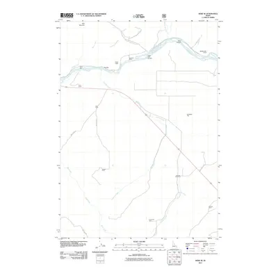
2011 Map of Heise SE
USGS Topo · Published 2011About this map
Snake River frontage and high desert ranching define this portion of Bonneville County, where the water flows through the Table Rock Canyon and past Open Canyon. The landscape is marked by a series of family-held properties that trace the settlement patterns of the region, including the Spaulding Ranch near the river and the Antelope Creek Ranch further south. To the north, the terrain rises toward Kelly Mountain and Rattlesnake Point, overlooking the alluvial expanses of Wolf Flat and Goe Flat. A network of rural routes, such as Moss Avery Rd and Birch Creek Rd, connects these remote outposts. The map documents a rugged agricultural environment where drainage systems like Antelope Creek and Little Pine Creek are central to the distribution of livestock and land use.
Find a feature on this map
30 named features on this map. Tap any name to fly to it.
Don’t see what you’re looking for? This feature index may not catch every label — zoom into the map to look around manually.
Map Details
Editions of this 2011 Heise SE Map
This is the sole edition of this map. No revisions or reprints were ever made.
Other maps of this area

1924 · Hell Creek
USGS Topo · 1:62,500

1926 · Hell Creek
USGS Topo · 1:62,500

1932 · Irwin
USGS Topo · 1:96,000

1935 · Irwin
USGS Topo · 1:125,000

1943 · Garns Mtn
USGS Topo · 1:62,500

1946 · Garns Mtn
USGS Topo · 1:62,500

1951 · Poplar
USGS Topo · 1:24,000

1951 · Hawley Gulch
USGS Topo · 1:24,000

1951 · Heise
USGS Topo · 1:24,000

1951 · Heise SE
USGS Topo · 1:24,000