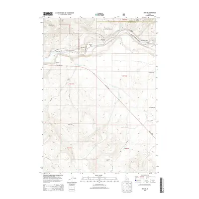
2013 Map of Heise SE
USGS Topo · Published 2013About this map
The Snake River carves a deep path through the northern reach of this landscape, separating the high elevations of Kelly Mtn from the expansive plateaus of the Targhee National Forest. The map documents a working ranching country where family holdings like Spaulding Ranch and Reed Ranch are distributed along the drainages of Antelope Cr and Birch Cr. This area of eastern Idaho, situated along the Swan Valley Hwy, shows a network of historical access roads including Burns Creek Rd and Moss Avery Rd that connect isolated flats and canyons. Distinctive geological markers such as Table Rock and the steep Fisher Canyon define the transition from the river bottom at Wolf Flat to the higher grazing lands at Antelope Flat. The survey provides an essential record of rural land use and named landmarks within the Madison and Bonneville county lines.
Find a feature on this map
41 named features on this map. Tap any name to fly to it.
Don’t see what you’re looking for? This feature index may not catch every label — zoom into the map to look around manually.
Map Details
Editions of this 2013 Heise SE Map
This is the sole edition of this map. No revisions or reprints were ever made.
Other maps of this area

1924 · Hell Creek
USGS Topo · 1:62,500

1926 · Hell Creek
USGS Topo · 1:62,500

1932 · Irwin
USGS Topo · 1:96,000

1935 · Irwin
USGS Topo · 1:125,000

1943 · Garns Mtn
USGS Topo · 1:62,500

1946 · Garns Mtn
USGS Topo · 1:62,500

1951 · Poplar
USGS Topo · 1:24,000

1951 · Hawley Gulch
USGS Topo · 1:24,000

1951 · Heise
USGS Topo · 1:24,000

1951 · Heise SE
USGS Topo · 1:24,000