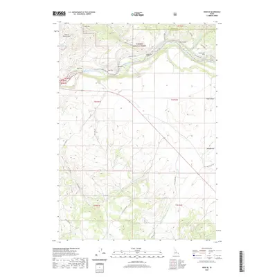
2020 Map of Heise SE
USGS Topo · Published 2020About this map
The South Fork Snake river system dominates this portion of Bonneville County, where the waterway carves through the landscape near Table Rock Canyon. This 2020 survey reveals a topography of distinct plateaus and drainage systems, including Wolf Flat and Goe Flat situated along the river's northern banks. Much of the northern terrain is managed as part of the Targhee National Forest, featuring prominent elevations like Kelly Mtn and the isolated Rattlesnake Point.
Find a feature on this map
37 named features on this map. Tap any name to fly to it.
Don’t see what you’re looking for? This feature index may not catch every label — zoom into the map to look around manually.
Map Details
Editions of this 2020 Heise SE Map
This is the sole edition of this map. No revisions or reprints were ever made.
Other maps of this area

1924 · Hell Creek
USGS Topo · 1:62,500

1926 · Hell Creek
USGS Topo · 1:62,500

1932 · Irwin
USGS Topo · 1:96,000

1935 · Irwin
USGS Topo · 1:125,000

1943 · Garns Mtn
USGS Topo · 1:62,500

1946 · Garns Mtn
USGS Topo · 1:62,500

1951 · Poplar
USGS Topo · 1:24,000

1951 · Hawley Gulch
USGS Topo · 1:24,000

1951 · Heise
USGS Topo · 1:24,000

1951 · Heise SE
USGS Topo · 1:24,000