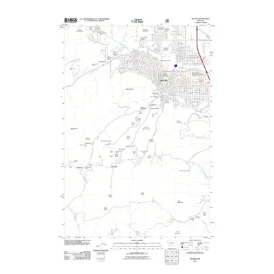
2011 Map of Helena
USGS Topo · Published 2011About this map
Helena serves as the focal point of this 2011 survey, showing the complex intersection of Montana’s state government and its deep-seated mining heritage. The map documents the city's modern layout, including the State Capitol Grounds and the historic Reeders Alley district, while tracing the northern edges of the mining country that originally built the town. To the south, the landscape is defined by steep drainages like Grizzly Gulch and Orofino Gulch, which are densely packed with mining claims and prospects such as the Oro Y Plata Mine and Bluebird Mine.
Find a feature on this map
93 named features on this map. Tap any name to fly to it.
Don’t see what you’re looking for? This feature index may not catch every label — zoom into the map to look around manually.
Map Details
Editions of this 2011 Helena Map
This is the sole edition of this map. No revisions or reprints were ever made.
Other maps of this area

1886 · Fort Logan
USGS Topo · 1:250,000

1889 · Helena
USGS Topo · 1:250,000

1893 · Helena
USGS Topo · 1:250,000

1899 · Boulder
USGS Topo · 1:125,000

1899 · Helena
USGS Topo · 1:62,500

1899 · Helena
USGS Topo · 1:250,000

1903 · Helena
USGS Topo · 1:250,000

1947 · Butte
USGS Topo · 1:250,000

1948 · White Sulphur Springs
USGS Topo · 1:250,000

1950 · Jefferson City
USGS Topo · 1:62,500