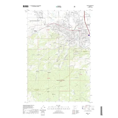
2020 Map of Helena
USGS Topo · Published 2020About this map
Helena serves as the focal point of this 2020 survey, where the urban grid of the state capital transitions abruptly into the steep, rising terrain of the Helena National Forest. The map documents a significant concentration of civic and institutional sites, including the Montana Supreme Court, Carroll College, and the sprawling MTA Fort Wm Henry Harrison to the west. Local history and genealogy are well-represented by numerous burial sites, from the Montana State Veterans Cem to the Lewis and Clark County Poor Farm Cem.
Find a feature on this map
159 named features on this map. Tap any name to fly to it.
Don’t see what you’re looking for? This feature index may not catch every label — zoom into the map to look around manually.
Map Details
Editions of this 2020 Helena Map
This is the sole edition of this map. No revisions or reprints were ever made.
Other maps of this area

1886 · Fort Logan
USGS Topo · 1:250,000

1889 · Helena
USGS Topo · 1:250,000

1893 · Helena
USGS Topo · 1:250,000

1899 · Boulder
USGS Topo · 1:125,000

1899 · Helena
USGS Topo · 1:62,500

1899 · Helena
USGS Topo · 1:250,000

1903 · Helena
USGS Topo · 1:250,000

1947 · Butte
USGS Topo · 1:250,000

1948 · White Sulphur Springs
USGS Topo · 1:250,000

1950 · Jefferson City
USGS Topo · 1:62,500