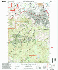
2001 Map of Helena
USGS Topo · Published 2004About this map
Helena serves as the focal point of this late 20th-century topographic record, showcasing the city's relationship with its surrounding mountain terrain and industrial history. The map details the urban core, featuring the State Capitol, Carroll College, and Capital HS, while also highlighting the federal presence at the Fort William H Harrison Military Reservation and the Veterans Administration Center. To the west and south, the landscape shifts abruptly into the gulches of the Helena National Forest, where the transition from city life to wilderness is defined by numerous prospects and old mining sites.
Find a feature on this map
48 named features on this map. Tap any name to fly to it.
Don’t see what you’re looking for? This feature index may not catch every label — zoom into the map to look around manually.
Map Details
Editions of this 2001 Helena Map
This is the sole edition of this map. No revisions or reprints were ever made.
Other maps of this area

1886 · Fort Logan
USGS Topo · 1:250,000

1889 · Helena
USGS Topo · 1:250,000

1893 · Helena
USGS Topo · 1:250,000

1899 · Boulder
USGS Topo · 1:125,000

1899 · Helena
USGS Topo · 1:62,500

1899 · Helena
USGS Topo · 1:250,000

1903 · Helena
USGS Topo · 1:250,000

1947 · Butte
USGS Topo · 1:250,000

1948 · White Sulphur Springs
USGS Topo · 1:250,000

1950 · Jefferson City
USGS Topo · 1:62,500