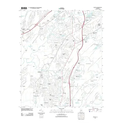
2011 Map of Helena
USGS Topo · Published 2011About this map
The Cahaba River winds through this 2011 survey, serving as a primary landscape feature for the growing communities of Helena and Pelham. The map details a transition from traditional river crossings like Greenlee Ford and Nunnally Ford to a dense network of suburban developments such as Indian Hills, Dearing Downs, and Navajo Hills. Genealogists will find several burial sites recorded, including the Cumberland Cemetery and David Lindsay Cemetery, which anchor the local history of these settlements. The inclusion of the Helena Post Office and numerous residential additions reflects the significant suburban expansion south of the metropolitan core during the early 21st century. Industrial and utility footprints, such as Patton Creek Dam and the Kimberly-Clark Lake, indicate the infrastructure supporting this regional growth.
Find a feature on this map
103 named features on this map. Tap any name to fly to it.
Don’t see what you’re looking for? This feature index may not catch every label — zoom into the map to look around manually.
Map Details
Editions of this 2011 Helena Map
This is the sole edition of this map. No revisions or reprints were ever made.
Other maps of this area

1890 · Bessemer
USGS Topo · 1:125,000

1892 · Bessemer
USGS Topo · 1:125,000

1905 · Bessemer Iron District
USGS Topo · 1:62,500

1906 · Vandiver
USGS Topo · 1:62,500

1907 · Bessemer Special
USGS Topo · 1:62,500

1908 · Vandiver
USGS Topo · 1:62,500

1909 · Columbiana
USGS Topo · 1:62,500

1910 · Montevallo
USGS Topo · 1:62,500

1911 · Columbiana
USGS Topo · 1:62,500

1953 · Birmingham
USGS Topo · 1:250,000