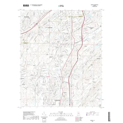
2018 Map of Helena
USGS Topo · Published 2018About this map
The Cahaba River winds through this corridor south of Birmingham, marking a landscape where suburban growth meets the industrial and geographic heritage of the Ridge-and-Valley Appalachians. Residential expansion in Hoover and Pelham surrounds older pockets like Acton and Hardy, while the CSX Transportation line and Interstate 65 anchor the regional transit network. Local history is preserved in several family and community burial grounds, including the David Lindsay Cem and Miller Cem, which sit alongside newer developments. The terrain is defined by prominent ridges such as Shades Mtn and Pine Mtn, creating distinct valleys like Fungo Hollow and Nelson Hollow. In the southern reaches, the city of Alabaster and the settlement of Scottrock show the continued southward reach of the metro area's development footprint.
Find a feature on this map
81 named features on this map. Tap any name to fly to it.
Don’t see what you’re looking for? This feature index may not catch every label — zoom into the map to look around manually.
Map Details
Editions of this 2018 Helena Map
This is the sole edition of this map. No revisions or reprints were ever made.
Other maps of this area

1890 · Bessemer
USGS Topo · 1:125,000

1892 · Bessemer
USGS Topo · 1:125,000

1905 · Bessemer Iron District
USGS Topo · 1:62,500

1906 · Vandiver
USGS Topo · 1:62,500

1907 · Bessemer Special
USGS Topo · 1:62,500

1908 · Vandiver
USGS Topo · 1:62,500

1909 · Columbiana
USGS Topo · 1:62,500

1910 · Montevallo
USGS Topo · 1:62,500

1911 · Columbiana
USGS Topo · 1:62,500

1953 · Birmingham
USGS Topo · 1:250,000