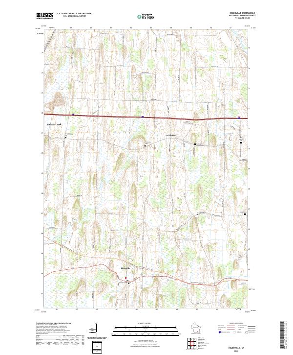
2022 Map of Helenville
USGS Topo · Published 2022About this map
Glacial topography and low-lying wetlands define the landscape between Johnson Creek and Helenville in this southeastern Wisconsin quadrangle. The terrain is marked by the Glacial Drumlin State Trail, which cuts across the southern portion of the map, following a relatively flat corridor through the marshy sections of Johnson Creek and Duck Creek. The rural character of Jefferson County is evident in the dense network of local roads such as Switzke Rd and Coffee Rd that serve the outlying farmsteads.
Find a feature on this map
71 named features on this map. Tap any name to fly to it.
Don’t see what you’re looking for? This feature index may not catch every label — zoom into the map to look around manually.
Map Details
Editions of this 2022 Helenville Map
This is the sole edition of this map. No revisions or reprints were ever made.
Other maps of this area

1891 · Waterloo
USGS Topo · 1:62,500

1891 · Koshkonong
USGS Topo · 1:62,500

1892 · Watertown
USGS Topo · 1:62,500

1892 · Whitewater
USGS Topo · 1:62,500

1893 · Whitewater
USGS Topo · 1:62,500

1894 · Waterloo
USGS Topo · 1:62,500

1894 · Watertown
USGS Topo · 1:62,500

1894 · Koshkonong
USGS Topo · 1:62,500

1903 · Whitewater
USGS Topo · 1:62,500

1906 · Koshkonong
USGS Topo · 1:62,500