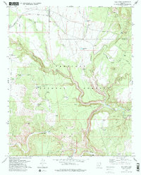
1979 Map of Hell Point
USGS Topo · Published 1979About this map
Prescott National Forest dominates this landscape, where the deeply incised Verde River meets the dramatic drainage of Hell Canyon. Traces of human presence across the centuries are marked by the Cliff Dwelling and various Ruins along the canyon walls, contrasting with the industrial presence of the United States Mine and several quarries to the northeast. The Gila and Salt River Meridian bisects the terrain, a foundational line for Arizona surveying that runs north through Rattlesnake Wash.
Find a feature on this map
51 named features on this map. Tap any name to fly to it.
Don’t see what you’re looking for? This feature index may not catch every label — zoom into the map to look around manually.
Map Details
Editions of this 1979 Hell Point Map
This is the sole edition of this map. No revisions or reprints were ever made.
Other maps of this area

1886 · Chino
USGS Topo · 1:250,000

1887 · Prescott
USGS Topo · 1:250,000

1891 · Chino
USGS Topo · 1:250,000

1892 · Prescott
USGS Topo · 1:250,000

1905 · Jerome
USGS Topo · 1:125,000

1922 · Williams
USGS Topo · 1:125,000

1944 · Clarkdale
USGS Topo · 1:48,000

1947 · Ash Fork
USGS Topo · 1:62,500

1947 · Paulden
USGS Topo · 1:62,500

1948 · Ash Fork
USGS Topo · 1:63,360