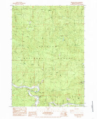
1984 Map of Hellion Rapids
USGS Topo · Published 1985About this map
Siuslaw National Forest encompasses most of this landscape, where the steep drainages of the Alsea River and Drift Creek meet. In the early 1980s, this area was characterized by a mix of active resource extraction and emerging recreational use. Numerous quarries and a Gravel Pit dot the ridges, particularly around Table Mountain, suggesting the industrial needs of forest road maintenance. Local history is anchored at the Bohannon Ranch (Site) in the north and the Fall Creek Fish Hatchery in the southeast.
Find a feature on this map
58 named features on this map. Tap any name to fly to it.
Don’t see what you’re looking for? This feature index may not catch every label — zoom into the map to look around manually.
Map Details
Editions of this 1984 Hellion Rapids Map
This is the sole edition of this map. No revisions or reprints were ever made.
Other maps of this area

1939 · Marys Peak
USGS Topo · 1:62,500

1942 · Marys Peak
USGS Topo · 1:62,500

1942 · Alsea
USGS Topo · 1:62,500

1942 · Tidewater
USGS Topo · 1:62,500

1942 · Toledo
USGS Topo · 1:62,500

1953 · Salem
USGS Topo · 1:250,000

1954 · Salem
USGS Topo · 1:250,000

1956 · Alsea
USGS Topo · 1:62,500

1956 · Tidewater
USGS Topo · 1:62,500

1957 · Marys Peak
USGS Topo · 1:62,500