
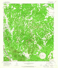
1953 Map of Helotes
USGS Topo · Published 1959About this map
Government Canyon dominates the western portion of this 1953 landscape, where the Balcones Escarpment transitions into the rugged drainage systems of Helotes Creek and French Creek. The small settlement of Helotes serves as a focal point, anchored by the Helotes Sch and the Church of Our Lady of Guadalupe. This era captures the community before the mid-century expansion of San Antonio reached these foothills, showing a dispersed rural pattern of homesteads and winding roads.
Find a feature on this map
11 named features on this map. Tap any name to fly to it.
Don’t see what you’re looking for? This feature index may not catch every label — zoom into the map to look around manually.
Map Details
Editions of this 1953 Helotes Map
This is the sole edition of this map. No revisions or reprints were ever made.
Other maps of this area

1953 · Otis Ridge
USGS Topo · 1:24,000

1953 · Culebra Hill
USGS Topo · 1:24,000

1953 · San Antonio West
USGS Topo · 1:24,000

1953 · Castle Hills
USGS Topo · 1:24,000

1953 · Van Raub
USGS Topo · 1:24,000

1954 · San Antonio
USGS Topo · 1:250,000

1956 · Medina Lake
USGS Topo · 1:62,500

1957 · San Antonio
USGS Topo · 1:250,000

1958 · La Coste NE
USGS Topo · 1:24,000
1965 · Camp Bullis
USGS Topo · 1:24,000