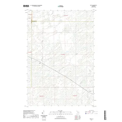
2019 Map of Helps
USGS Topo · Published 2019About this map
Helps and Faunus stand as the primary reference points in this northern Michigan landscape where the headwaters of several drainage systems converge. The terrain is defined by the complex hydrology of the Upper Peninsula, featuring the W Br Ford River and the S Br Ford River, which meander through a series of wetland basins. The road network, including G 30 Rd and Stebbins Rd, follows the higher ground between these watercourses. This 2019 survey illustrates the persistent rural character of Dickinson County and its borders with Marquette Co and Menominee Co. Notable local landmarks like Stephenson Lake and the winding course of Skidmore Cr provide specific geographic orientation within the township system. The map reflects a landscape primarily utilized for its natural resources and timber, with widely spaced settlements connected by long secondary roads.
Find a feature on this map
28 named features on this map. Tap any name to fly to it.
Don’t see what you’re looking for? This feature index may not catch every label — zoom into the map to look around manually.
Map Details
Editions of this 2019 Helps Map
This is the sole edition of this map. No revisions or reprints were ever made.
Other maps of this area
1932 · Helena SW
USGS Topo · 1:31,680
1951 · Helena SW
USGS Topo · 1:31,680
1954 · Escanaba
USGS Topo · 1:250,000
1956 · Foster City
USGS Topo · 1:62,500
1957 · Escanaba
USGS Topo · 1:250,000
1957 · Northland
USGS Topo · 1:62,500
1958 · Escanaba
USGS Topo · 1:250,000
1958 · Marquette
USGS Topo · 1:250,000
1960 · Marquette
USGS Topo · 1:250,000
1961 · Marquette
USGS Topo · 1:250,000