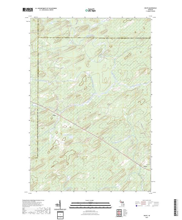
2023 Map of Helps
USGS Topo · Published 2023About this map
Helps and Faunus stand as the primary points of settlement in this northern Michigan wilderness, situated where the borders of Menominee, Dickinson, and Marquette counties converge. The landscape is defined by an intricate network of waterways, including the West Branch Ford River and the South Branch Ford River, which drain through the timberlands toward the south and east. Historic transportation corridors dictate the geography of the area, most notably the Felch Grade Route/Trl and the Powers-Arnold Route, which trace former railroad alignments through the swamps and forests. Stephenson Lake and numerous creeks such as Helps Creek and Kimberley Creek suggest a terrain heavily influenced by glacial deposits and low-lying drainage basins. The road network, including G 30 Rd and Stebbins Rd, remains relatively sparse, reflecting the rural character of this Upper Peninsula interior.
Find a feature on this map
30 named features on this map. Tap any name to fly to it.
Don’t see what you’re looking for? This feature index may not catch every label — zoom into the map to look around manually.
Map Details
Editions of this 2023 Helps Map
This is the sole edition of this map. No revisions or reprints were ever made.
Other maps of this area

1932 · Helena SW
USGS Topo · 1:31,680

1951 · Helena SW
USGS Topo · 1:31,680

1954 · Escanaba
USGS Topo · 1:250,000

1956 · Foster City
USGS Topo · 1:62,500

1957 · Escanaba
USGS Topo · 1:250,000

1957 · Northland
USGS Topo · 1:62,500

1958 · Escanaba
USGS Topo · 1:250,000

1958 · Marquette
USGS Topo · 1:250,000

1960 · Marquette
USGS Topo · 1:250,000

1961 · Marquette
USGS Topo · 1:250,000