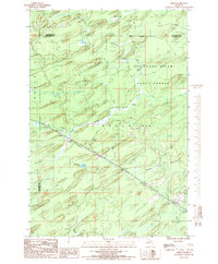
1986 Map of Helps
USGS Topo · Published 1986About this map
The settlement of Helps and the crossing of Faunus anchor this mid-1980s look at the intersection of Menominee, Marquette, and Dickinson counties. Much of the landscape is defined by the Escanaba River State Forest, a terrain of wetlands and seasonal drainages. The Old Railroad Grade cuts a diagonal path through the center of the sheet, tracing the legacy of the region's logging or industrial transport routes that once connected these isolated outposts.
Find a feature on this map
18 named features on this map. Tap any name to fly to it.
Don’t see what you’re looking for? This feature index may not catch every label — zoom into the map to look around manually.
Map Details
Editions of this 1986 Helps Map
This is the sole edition of this map. No revisions or reprints were ever made.
Other maps of this area

1932 · Helena SW
USGS Topo · 1:31,680

1951 · Helena SW
USGS Topo · 1:31,680

1954 · Escanaba
USGS Topo · 1:250,000

1956 · Foster City
USGS Topo · 1:62,500

1957 · Escanaba
USGS Topo · 1:250,000

1957 · Northland
USGS Topo · 1:62,500

1958 · Escanaba
USGS Topo · 1:250,000

1958 · Marquette
USGS Topo · 1:250,000

1960 · Marquette
USGS Topo · 1:250,000

1961 · Marquette
USGS Topo · 1:250,000