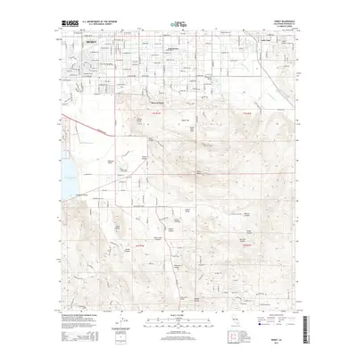
2015 Map of Hemet
USGS Topo · Published 2015About this map
Hemet and its eastern suburbs sit at the base of the Santa Rosa Hills, where the suburban grid of the San Jacinto Valley meets the rising mountain terrain. The 2015 landscape is defined by the massive Diamond Valley Lake to the west, a primary reservoir that dominates the local topography alongside Diamond Valley. In the north, the residential developments of East Hemet and Valle Vista are bordered by the seasonal drainage of Bautista Wash.
Find a feature on this map
69 named features on this map. Tap any name to fly to it.
Don’t see what you’re looking for? This feature index may not catch every label — zoom into the map to look around manually.
Map Details
Editions of this 2015 Hemet Map
This is the sole edition of this map. No revisions or reprints were ever made.
Other maps of this area

1901 · Southern California Sheet No. 1
USGS Topo · 1:250,000

1901 · San Jacinto
USGS Topo · 1:125,000

1901 · Elsinore
USGS Topo · 1:125,000

1904 · Southern California Sheet No. 1
USGS Topo · 1:250,000

1942 · Banning
USGS Topo · 1:62,500

1942 · Hemet
USGS Topo · 1:62,500

1942 · Murrieta
USGS Topo · 1:62,500

1942 · Perris
USGS Topo · 1:62,500

1943 · Perris
USGS Topo · 1:62,500

1943 · Hemet
USGS Topo · 1:62,500