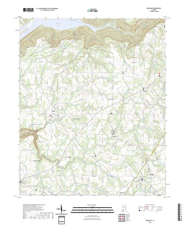
2024 Map of Henagar
USGS Topo · Published 2024About this map
Sand Mountain dominates the landscape south of the Tennessee River and Guntersville Lake, where a plateau of small farming communities sits high above the river bottom. Near the northern rim, the terrain drops sharply at Coon Gulf and Coon Gap, while the interior of the plateau is carved by an intricate network of creeks like Bryant Creek and Horsehead Creek. This 2024 survey captures the long-established settlement pattern of northeastern Alabama, where crossroads such as Pisgah, Rosalie, and Henagar are anchored by family names and rural churches.
Find a feature on this map
147 named features on this map. Tap any name to fly to it.
Don’t see what you’re looking for? This feature index may not catch every label — zoom into the map to look around manually.
Map Details
Editions of this 2024 Henagar Map
This is the sole edition of this map. No revisions or reprints were ever made.
Other maps of this area

1886 · Stevenson
USGS Topo · 1:125,000

1892 · Stevenson
USGS Topo · 1:125,000

1895 · Stevenson
USGS Topo · 1:125,000

1936 · Ider
USGS Topo · 1:24,000

1936 · Wannville
USGS Topo · 1:24,000

1936 · Flat Rock
USGS Topo · 1:24,000

1936 · Dugout Valley
USGS Topo · 1:24,000

1936 · Dutton
USGS Topo · 1:24,000

1936 · Sylvania
USGS Topo · 1:24,000

1936 · Hollywood
USGS Topo · 1:24,000