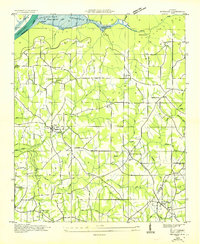
1936 Map of Henagar
USGS Topo · Published 1936About this map
Guntersville Reservoir and its proposed northern boundary define the upper reaches of this survey, where the Tennessee Valley Authority was actively shaping the landscape through hydroelectric planning. Positioned on the high plateau of Sand Mountain, the region's rural character is marked by a dense network of country schools and churches that served small agrarian communities like Pisgah and Henagar. The map records a moment when local life centered around points like Central Crossroads and small general stores such as Fair View Store.
Find a feature on this map
57 named features on this map. Tap any name to fly to it.
Don’t see what you’re looking for? This feature index may not catch every label — zoom into the map to look around manually.
Map Details
Editions of this 1936 Henagar Map
This is the sole edition of this map. No revisions or reprints were ever made.
Other maps of this area

1886 · Stevenson
USGS Topo · 1:125,000

1892 · Stevenson
USGS Topo · 1:125,000

1895 · Stevenson
USGS Topo · 1:125,000

1936 · Ider
USGS Topo · 1:24,000

1936 · Wannville
USGS Topo · 1:24,000

1936 · Flat Rock
USGS Topo · 1:24,000

1936 · Dugout Valley
USGS Topo · 1:24,000

1936 · Dutton
USGS Topo · 1:24,000

1936 · Sylvania
USGS Topo · 1:24,000

1936 · Hollywood
USGS Topo · 1:24,000