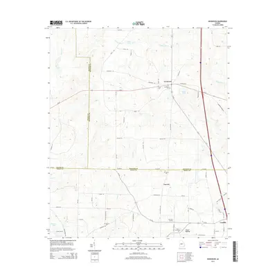
2014 Map of Henderson
USGS Topo · Published 2014About this map
Henderson and the agricultural lands of central Georgia define this 2014 survey, where the borders of Houston, Dooly, and Macon counties converge. The landscape is structured by a network of rural routes and watercourses, including Big Cr and Turkey Cr, which drain toward Thompson Lake in the southwest. Small settlements and community landmarks are scattered throughout, such as Emerich and Snow Spring, providing geographic anchor points for local history.
Find a feature on this map
66 named features on this map. Tap any name to fly to it.
Don’t see what you’re looking for? This feature index may not catch every label — zoom into the map to look around manually.
Map Details
Editions of this 2014 Henderson Map
This is the sole edition of this map. No revisions or reprints were ever made.
Other maps of this area

1956 · Perry
USGS Topo · 1:62,500

1957 · Macon
USGS Topo · 1:250,000

1958 · Macon
USGS Topo · 1:250,000

1964 · Macon
USGS Topo · 1:250,000

1971 · Pineview NW
USGS Topo · 1:24,000

1971 · Henderson
USGS Topo · 1:24,000

1971 · Pinehurst
USGS Topo · 1:24,000

1972 · Byromville
USGS Topo · 1:24,000
1972 · Marshallville
USGS Topo · 1:24,000
1972 · Marshallville SW
USGS Topo · 1:24,000