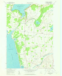
1959 Map of Henderson
USGS Topo · Published 1961About this map
Henderson Harbor and the eastern reaches of Lake Ontario anchor this 1959 topographic survey of Jefferson County. The landscape is defined by the transition from the rocky coastline at Stony Point to the fertile agricultural lands of Henderson and Ellisburg townships. A dense network of local roads, such as Military Road and Snowshoe Road, connects small crossroads settlements including Aspinwall Corners, Hungerford Corners, and Scotts Corners. For genealogists, the map is particularly detailed, identifying numerous family-named burial grounds like Stowles Cem and Carpenter Cem. Along the shore, the presence of Jefferson Park and El Dorado Beach points to the area's mid-century role as a summer destination, while interior features like Stony Creek and several active quarries reflect the local rural economy of the late 1950s.
Find a feature on this map
71 named features on this map. Tap any name to fly to it.
Don’t see what you’re looking for? This feature index may not catch every label — zoom into the map to look around manually.
Map Details
Editions of this 1959 Henderson Map
Other maps of this area

1893 · Sackets Harbor
USGS Topo · 1:62,500

1895 · Sacketts Harbor
USGS Topo · 1:62,500

1895 · Stony Island
USGS Topo · 1:62,500

1895 · Pulaski
USGS Topo · 1:62,500

1942 · Stony Point
USGS Topo · 1:31,680

1942 · Henderson Bay
USGS Topo · 1:31,680

1942 · Point Peninsula
USGS Topo · 1:31,680

1942 · Sandy Creek
USGS Topo · 1:24,000

1943 · Henderson
USGS Topo · 1:31,680
1943 · Sackets Harbor
USGS Topo · 1:31,680