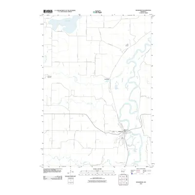
2010 Map of Henderson
USGS Topo · Published 2010About this map
The Minnesota River snakes through the eastern portion of this landscape, its winding course defining the geography near the city of Henderson. As of 2010, the river's floodplains and oxbows are flanked by a network of drainage and tributaries, including Buffalo Creek and the Rush River to the south, and High Island Creek flowing through the center. The High Island Creek Dam stands near the western edge of the quadrangle, while Silver Lake dominates the northwest corner.
Find a feature on this map
45 named features on this map. Tap any name to fly to it.
Don’t see what you’re looking for? This feature index may not catch every label — zoom into the map to look around manually.
Map Details
Editions of this 2010 Henderson Map
This is the sole edition of this map. No revisions or reprints were ever made.
Other maps of this area

1953 · Saint Paul
USGS Topo · 1:250,000

1953 · New Ulm
USGS Topo · 1:250,000

1957 · New Ulm
USGS Topo · 1:250,000

1957 · Belle Plaine
USGS Topo · 1:62,500

1958 · New Ulm
USGS Topo · 1:250,000

1958 · Gaylord
USGS Topo · 1:62,500

1959 · Saint Paul
USGS Topo · 1:250,000

1965 · Norseland
USGS Topo · 1:24,000

1965 · Le Sueur
USGS Topo · 1:24,000

1965 · St Thomas
USGS Topo · 1:24,000