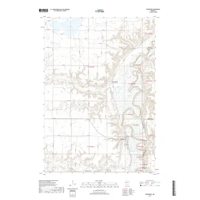
2019 Map of Henderson
USGS Topo · Published 2019About this map
The Minnesota River carves a deep, winding valley through this region, creating a dramatic landscape where the uplands of Maple Ridge overlook the fertile river bottomlands. This modern survey illustrates the enduring agricultural and township patterns of Sibley, Scott, and Le Sueur counties. The settlement of Henderson serves as a focal point, situated at the base of the western bluffs near the mouth of Rush River.
Find a feature on this map
46 named features on this map. Tap any name to fly to it.
Don’t see what you’re looking for? This feature index may not catch every label — zoom into the map to look around manually.
Map Details
Editions of this 2019 Henderson Map
This is the sole edition of this map. No revisions or reprints were ever made.
Other maps of this area

1953 · Saint Paul
USGS Topo · 1:250,000

1953 · New Ulm
USGS Topo · 1:250,000

1957 · New Ulm
USGS Topo · 1:250,000

1957 · Belle Plaine
USGS Topo · 1:62,500

1958 · New Ulm
USGS Topo · 1:250,000

1958 · Gaylord
USGS Topo · 1:62,500

1959 · Saint Paul
USGS Topo · 1:250,000

1965 · Norseland
USGS Topo · 1:24,000

1965 · Le Sueur
USGS Topo · 1:24,000

1965 · St Thomas
USGS Topo · 1:24,000