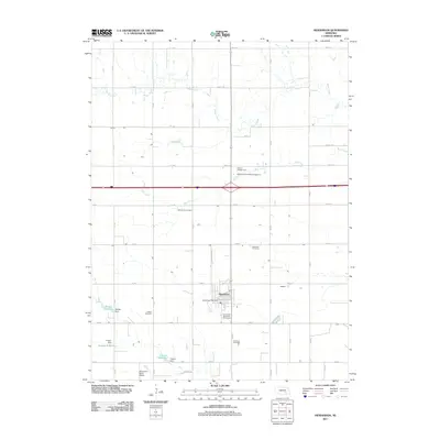
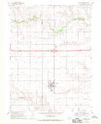
2011 Map of Henderson
USGS Topo · Published 2011About this map
Henderson serves as the central hub of this agricultural landscape in York County, defined by a rigorous grid of section-line roads and the winding paths of Beaver Creek and Bear Creek. The map reveals a deeply rooted community, evidenced by several denominational and family burial grounds including the Mennonite Cemetery, Bethesda Cemetery, Friesen Cemetery, and Ebenezer Cemetery. This concentration of cemeteries provides a clear record of the area's ancestral settlement patterns. The infrastructure of the early 21st century is well-represented by the Henderson Post Office, the Henderson Municipal Golf Course, and recreational sites like the Henderson/York KOA Kampground. Water management is prominent in the southern reach of the quadrangle, where the Bergen Dam and Friesen Dam create the Bergen Reservoir and Friesen Reservoir, respectively. Aviation history is also marked at the small Boardman Aerial Airport south of the town center.
Find a feature on this map
45 named features on this map. Tap any name to fly to it.
Don’t see what you’re looking for? This feature index may not catch every label — zoom into the map to look around manually.
Map Details
Editions of this 2011 Henderson Map
This is the sole edition of this map. No revisions or reprints were ever made.
Other maps of this area

1898 · York
USGS Topo · 1:125,000

1899 · York
USGS Topo · 1:125,000

1955 · Lincoln
USGS Topo · 1:250,000

1957 · Lincoln
USGS Topo · 1:250,000

1958 · Lincoln
USGS Topo · 1:250,000
1968 · Aurora East
USGS Topo · 1:24,000
1968 · Hampton
USGS Topo · 1:24,000
1968 · Henderson NE
USGS Topo · 1:24,000
1968 · Henderson
USGS Topo · 1:24,000

1969 · Bixby
USGS Topo · 1:24,000