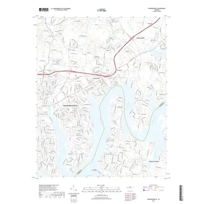
2019 Map of Hendersonville
USGS Topo · Published 2019About this map
Cumberland River frontage defines this 2019 survey, where the waterway meanders past Lindsley Bend and Cages Bend along the boundary of Sumner and Wilson counties. The suburban growth of Hendersonville and Gallatin is evident, yet the landscape preserves important local heritage sites. Genealogists can locate Stark Knob Cem and Woodlawn Cem, which sit near long-established corridors like Long Hollow Pike and Nashville Pike. The map illustrates a complex network of residential development integrated with natural features like Drakes Creek and Station Camp Creek. Smaller communities such as Saundersville and Peytona maintain their identities within this shifting landscape, while newer landmarks like Five Coves Lake reflect the modern character of the river valley near Mount Juliet.
Find a feature on this map
36 named features on this map. Tap any name to fly to it.
Don’t see what you’re looking for? This feature index may not catch every label — zoom into the map to look around manually.
Map Details
Editions of this 2019 Hendersonville Map
This is the sole edition of this map. No revisions or reprints were ever made.
Other maps of this area

1903 · Nashville
USGS Topo · 1:125,000

1932 · Hermitage
USGS Topo · 1:62,500

1942 · Gallatin
USGS Topo · 1:100,000

1942 · Lebanon
USGS Topo · 1:100,000

1951 · Martha
USGS Topo · 1:24,000

1952 · Goodlettsville
USGS Topo · 1:24,000

1952 · Hendersonville
USGS Topo · 1:24,000

1952 · Hermitage
USGS Topo · 1:24,000

1952 · Nashville East
USGS Topo · 1:24,000

1953 · Cottontown
USGS Topo · 1:24,000