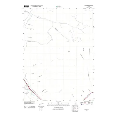
2010 Map of Henefer
USGS Topo · Published 2010About this map
The Weber River corridor serves as the primary artery for settlement and transport in this 2010 depiction of the Henefer area. The town of Henefer is positioned at the intersection of several local routes, including E Henefer Rd and S Henefer Rd, with the nearby Henefer Cemetery providing a significant point of interest for local history and genealogy. The surrounding landscape is defined by an intricate network of deep drainages such as Black Hawk Canyon, Wolf Den Canyon, and Sawmill Canyon, which carve through the high ground of Middle Ridge and Windy Knoll. To the northeast, the settlement of China Town sits near the head of Cedar Canyon, while the confluence of Echo Creek and the Weber River anchors the southeastern corner of the quadrangle. This map documents a region where river-valley agriculture and residential life transition into the high, rugged canyons of the Wasatch range.
Find a feature on this map
43 named features on this map. Tap any name to fly to it.
Don’t see what you’re looking for? This feature index may not catch every label — zoom into the map to look around manually.
Map Details
Editions of this 2010 Henefer Map
This is the sole edition of this map. No revisions or reprints were ever made.
Other maps of this area

1885 · Salt Lake
USGS Topo · 1:250,000

1900 · Coalville
USGS Topo · 1:125,000

1903 · Coalville
USGS Topo · 1:125,000

1925 · Ft. Douglas
USGS Topo · 1:125,000

1928 · Ft. Douglas
USGS Topo · 1:125,000

1954 · Salt Lake City
USGS Topo · 1:250,000

1954 · Ogden
USGS Topo · 1:250,000

1958 · Ogden
USGS Topo · 1:250,000

1958 · Salt Lake City
USGS Topo · 1:250,000

1960 · Ogden
USGS Topo · 1:250,000