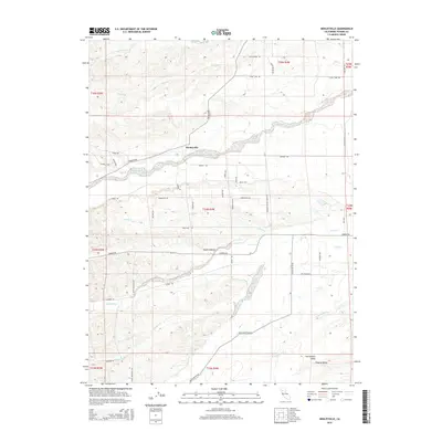
2015 Map of Henleyville
USGS Topo · Published 2015About this map
Henleyville sits as the primary settlement on this portion of the Sacramento Valley, where the terrain transitions from the lowlands into the dissected foothills. The landscape is defined by a dense network of seasonal and perennial drainages including Thomes Cr, Jewett Cr, and Coyote Cr, which cut through the undulating ground of Squaw Hollow and the surrounding rangeland.
Find a feature on this map
52 named features on this map. Tap any name to fly to it.
Don’t see what you’re looking for? This feature index may not catch every label — zoom into the map to look around manually.
Map Details
Editions of this 2015 Henleyville Map
This is the sole edition of this map. No revisions or reprints were ever made.
Other maps of this area

1890 · Red Bluff
USGS Topo · 1:250,000

1894 · Red Bluff
USGS Topo · 1:250,000

1904 · Vina
USGS Topo · 1:62,500

1905 · Tehama
USGS Topo · 1:62,500

1914 · Kirkwood
USGS Topo · 1:31,680

1944 · Flournoy
USGS Topo · 1:62,500
1949 · Kirkwood
USGS Topo · 1:24,000
1950 · Kirkwood
USGS Topo · 1:24,000

1950 · Gerber
USGS Topo · 1:24,000

1951 · Gerber
USGS Topo · 1:24,000