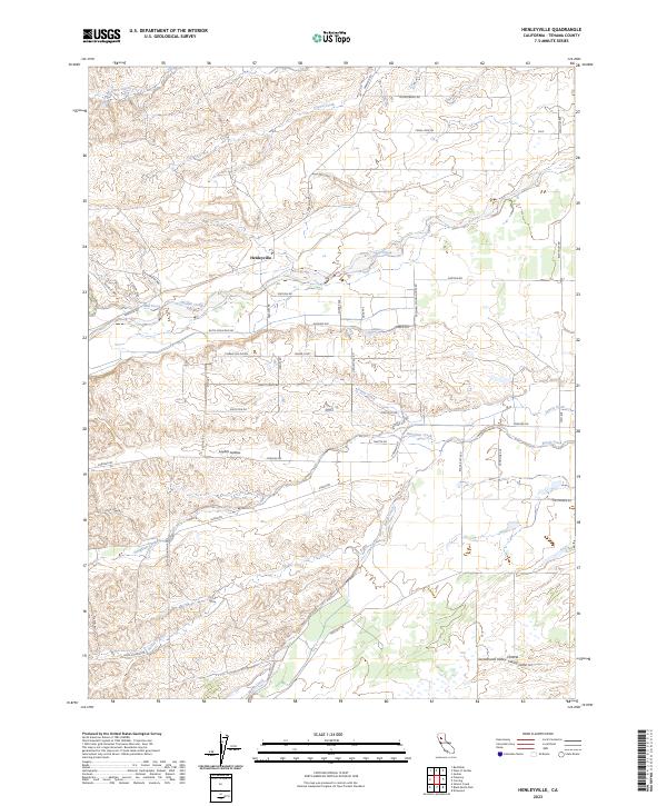
2023 Map of Henleyville
USGS Topo · Published 2023About this map
Henleyville sits as the central settlement in this agricultural portion of the Sacramento Valley, where the landscape transitions from the flat plains of the Central Valley into the dissected foothills to the west. The drainage pattern is the defining characteristic of this terrain, with numerous seasonal and perennial waterways like Thomes Creek, Jewett Creek, and Burch Creek carving paths toward the valley floor. Roads such as Freeman Schoolhouse Rd, Almond Ave, and Cherry Ave reflect the region's orchard heritage and rural infrastructure. A distinct topographic shift occurs at Laybas Hollow, marking the change from level valley soils to the more complex ridges and draws near Butte Mountain Rd. This layout reveals the enduring intersection of water management and orchard-based agriculture that has shaped this part of Tehama County for generations.
Find a feature on this map
58 named features on this map. Tap any name to fly to it.
Don’t see what you’re looking for? This feature index may not catch every label — zoom into the map to look around manually.
Map Details
Editions of this 2023 Henleyville Map
This is the sole edition of this map. No revisions or reprints were ever made.
Other maps of this area

1890 · Red Bluff
USGS Topo · 1:250,000

1894 · Red Bluff
USGS Topo · 1:250,000

1904 · Vina
USGS Topo · 1:62,500

1905 · Tehama
USGS Topo · 1:62,500

1914 · Kirkwood
USGS Topo · 1:31,680

1944 · Flournoy
USGS Topo · 1:62,500
1949 · Kirkwood
USGS Topo · 1:24,000
1950 · Kirkwood
USGS Topo · 1:24,000

1950 · Gerber
USGS Topo · 1:24,000

1951 · Gerber
USGS Topo · 1:24,000