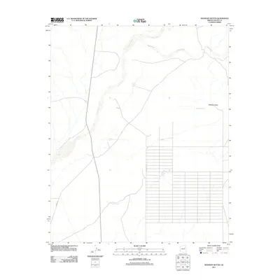
2011 Map of Hennessy Buttes
USGS Topo · Published 2011About this map
Hennessy Buttes rise above a landscape defined by an extensive drainage network and the developing grid of S Sun Valley Rd. This arid region of Navajo County is crisscrossed by significant seasonal waterways including Leroux Wash and Digger Wash, which dictate the placement of ranching infrastructure. The land is punctuated by numerous catchment systems such as Four Section Tank, Two Section Tank, and Spurlock Tank, highlighting the critical role of water management in this high-desert environment. Further south, Wagon Lake Tank and Sand Tank provide additional evidence of the regional dependence on these engineered water sources. The transition from the natural winding paths of the washes to the rigid, surveyed street layouts near Mission Ln illustrates the encroaching modern residential planning within a traditionally open range.
Find a feature on this map
10 named features on this map. Tap any name to fly to it.
Don’t see what you’re looking for? This feature index may not catch every label — zoom into the map to look around manually.
Map Details
Editions of this 2011 Hennessy Buttes Map
This is the sole edition of this map. No revisions or reprints were ever made.
Other maps of this area

1883 · Tusayan
USGS Topo · 1:250,000

1886 · St Johns
USGS Topo · 1:250,000

1886 · Tusayan
USGS Topo · 1:250,000

1886 · Fort Defiance
USGS Topo · 1:250,000

1886 · Holbrook
USGS Topo · 1:250,000

1892 · Fort Defiance
USGS Topo · 1:250,000

1892 · St Johns
USGS Topo · 1:250,000

1893 · Holbrook
USGS Topo · 1:250,000

1912 · Petrified Forest
USGS Topo · 1:62,500

1947 · Flagstaff
USGS Topo · 1:250,000