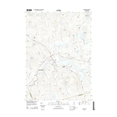
2015 Map of Henniker
USGS Topo · Published 2015About this map
The Contoocook River defines the central geography of this New Hampshire landscape, winding through a valley of interconnected villages and academic grounds. Henniker serves as the primary hub, home to New England College and the landmark Henniker Bridge. The map details the transition from the riverfront to the upland peaks of Mt Hunger and Mt Misery, showing a traditional New England settlement pattern of scattered hilltop farms and valley industries. Genealogy researchers can find several burial grounds, including the Friends Cem and Plummer Cem, while transport historians may trace the rail-influenced layout of Henniker Junction and West Henniker Emerson Station. The surrounding hills, such as Craney Hill and Morrill Hill, are dotted with several small water bodies like Clement Pond and Craney Pond, illustrating the post-glacial terrain typical of the region.
Find a feature on this map
125 named features on this map. Tap any name to fly to it.
Don’t see what you’re looking for? This feature index may not catch every label — zoom into the map to look around manually.
Map Details
Editions of this 2015 Henniker Map
This is the sole edition of this map. No revisions or reprints were ever made.
Other maps of this area

1926 · Hillsboro
USGS Topo · 1:62,500

1927 · Concord
USGS Topo · 1:62,500

1927 · Penacook
USGS Topo · 1:62,500

1928 · Mount Kearsarge
USGS Topo · 1:62,500

1929 · Hillsboro
USGS Topo · 1:62,500

1931 · Mount Kearsarge
USGS Topo · 1:62,500

1949 · Portland
USGS Topo · 1:250,000

1949 · Concord
USGS Topo · 1:62,500

1956 · Penacook
USGS Topo · 1:62,500

1956 · Mt. Kearsarge
USGS Topo · 1:62,500