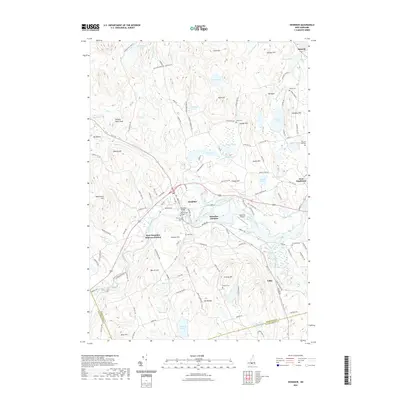
2021 Map of Henniker
USGS Topo · Published 2021About this map
Henniker and its surrounding hills center this 2021 study, where the Contoocook River winds through a landscape of historic academic and rail infrastructure. The campus of New England College is clearly defined near the Henniker Bridge, while the historical rail corridor is marked by Henniker Junction and West Henniker Emerson Station. The map illustrates the region's complex topography, showing prominent summits like Craney Hill and Windsor Ward Peak rising above a network of smaller water bodies such as Clement Pond and Keyser Pond.
Find a feature on this map
130 named features on this map. Tap any name to fly to it.
Don’t see what you’re looking for? This feature index may not catch every label — zoom into the map to look around manually.
Map Details
Editions of this 2021 Henniker Map
This is the sole edition of this map. No revisions or reprints were ever made.
Other maps of this area

1926 · Hillsboro
USGS Topo · 1:62,500

1927 · Concord
USGS Topo · 1:62,500

1927 · Penacook
USGS Topo · 1:62,500

1928 · Mount Kearsarge
USGS Topo · 1:62,500

1929 · Hillsboro
USGS Topo · 1:62,500

1931 · Mount Kearsarge
USGS Topo · 1:62,500

1949 · Portland
USGS Topo · 1:250,000

1949 · Concord
USGS Topo · 1:62,500

1956 · Penacook
USGS Topo · 1:62,500

1956 · Mt. Kearsarge
USGS Topo · 1:62,500