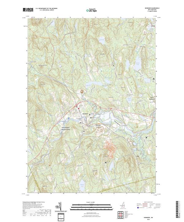
2024 Map of Henniker
USGS Topo · Published 2024About this map
The Contoocook River winds through this New Hampshire terrain, anchoring a series of small settlements and transportation hubs. At the center of the sheet, the town of Henniker is notably defined by the campus of New England College, surrounded by local landmarks like the First Burial Yard and Henniker Cem North. To the west, Emerson Station and West Henniker mark the river's path, while the name Henniker Junction points to the area's rail history. The landscape is heavily textured with high points such as Windsor Ward Peak, Craney Hill, and Proctor Hill, which look down upon numerous water bodies including French Pond, Keyser Pond, and Clement Pond. Genealogists will find a wealth of burial sites, from the Friends Cem to the Chase Cem and Plummer Cem, reflecting generations of settlement across the hills of Merrimack County and Hillsborough County.
Find a feature on this map
130 named features on this map. Tap any name to fly to it.
Don’t see what you’re looking for? This feature index may not catch every label — zoom into the map to look around manually.
Map Details
Editions of this 2024 Henniker Map
This is the sole edition of this map. No revisions or reprints were ever made.
Other maps of this area

1926 · Hillsboro
USGS Topo · 1:62,500

1927 · Concord
USGS Topo · 1:62,500

1927 · Penacook
USGS Topo · 1:62,500

1928 · Mount Kearsarge
USGS Topo · 1:62,500

1929 · Hillsboro
USGS Topo · 1:62,500

1931 · Mount Kearsarge
USGS Topo · 1:62,500

1949 · Portland
USGS Topo · 1:250,000

1949 · Concord
USGS Topo · 1:62,500

1956 · Penacook
USGS Topo · 1:62,500

1956 · Mt. Kearsarge
USGS Topo · 1:62,500