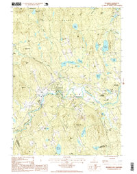
1995 Map of Henniker
USGS Topo · Published 1999About this map
The Contoocook River winds through this New Hampshire landscape, defining the character of Henniker and its smaller satellite settlements at the close of the twentieth century. The map highlights the town's industrial and transportation history through the Old Railroad Grade that follows the river's path, connecting West Henniker and Henniker Junction. This corridor reveals how local industry was once tied to the waterway and rail network before shifting toward the residential and recreational patterns visible here.
Find a feature on this map
59 named features on this map. Tap any name to fly to it.
Don’t see what you’re looking for? This feature index may not catch every label — zoom into the map to look around manually.
Map Details
Editions of this 1995 Henniker Map
This is the sole edition of this map. No revisions or reprints were ever made.
Other maps of this area

1926 · Hillsboro
USGS Topo · 1:62,500

1927 · Concord
USGS Topo · 1:62,500

1927 · Penacook
USGS Topo · 1:62,500

1928 · Mount Kearsarge
USGS Topo · 1:62,500

1929 · Hillsboro
USGS Topo · 1:62,500

1931 · Mount Kearsarge
USGS Topo · 1:62,500

1949 · Portland
USGS Topo · 1:250,000

1949 · Concord
USGS Topo · 1:62,500

1956 · Penacook
USGS Topo · 1:62,500

1956 · Mt. Kearsarge
USGS Topo · 1:62,500