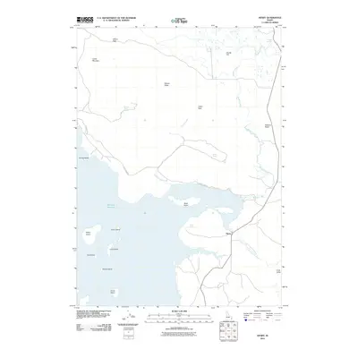
2010 Map of Henry
USGS Topo · Published 2010About this map
Blackfoot Reservoir dominates the western half of this Caribou County landscape, characterized by numerous islands and complex shoreline features such as Sheep Island, Gull Island, and the elongated Willow Island. The settlement of Henry sits at a crossroads to the southeast, where the Little Blackfoot River enters the plains near Long Valley. The topography rises sharply to the north and east, marked by prominent landmarks like Crater Mountain and Pelican Ridge. This 2010 survey illustrates the water-dependent nature of the region, documenting several named water sources including Gaston Beatty Spring, Warm Spring, and Rosie Spring. Historical naming is evident at Robbers Roost along the eastern road corridor, while the expansive Chubb Flat and Chubb Springs occupy the northern reaches of the quadrangle, connected by the flow of Meadow Creek.
Find a feature on this map
25 named features on this map. Tap any name to fly to it.
Don’t see what you’re looking for? This feature index may not catch every label — zoom into the map to look around manually.
Map Details
Editions of this 2010 Henry Map
This is the sole edition of this map. No revisions or reprints were ever made.
Other maps of this area

1914 · Henry
USGS Topo · 1:48,000

1915 · Lanes Creek
USGS Topo · 1:62,500

1916 · Henry
USGS Topo · 1:62,500

1917 · Cranes Flat
USGS Topo · 1:62,500

1932 · Irwin
USGS Topo · 1:96,000

1935 · Irwin
USGS Topo · 1:125,000

1949 · Lower Valley
USGS Topo · 1:24,000

1951 · Lower Valley
USGS Topo · 1:24,000

1955 · Driggs
USGS Topo · 1:250,000

1955 · Preston
USGS Topo · 1:250,000