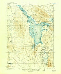
1916 Map of Henry
USGS Topo · Published 1948About this map
The Blackfoot River Reservoir dominates this landscape in Caribou County, where volcanic geography meets early twentieth-century water management. Surveyed between 1910 and 1914, the map documents the area shortly after the completion of the Blackfoot Dam, showing how the impounded waters reshaped the valley floor once characterized by a massive Lava Field. The presence of numerous craters and cones, such as China Hat, Middle Cone, and Broken Crater, highlights the area's distinct geologic origins.
Find a feature on this map
40 named features on this map. Tap any name to fly to it.
Don’t see what you’re looking for? This feature index may not catch every label — zoom into the map to look around manually.
Map Details
Editions of this 1916 Henry Map
2 editions found
Other maps of this area

1911 · Slug Creek
USGS Topo · 1:62,500

1914 · Henry
USGS Topo · 1:48,000

1915 · Lanes Creek
USGS Topo · 1:62,500

1916 · Henry
USGS Topo · 1:62,500

1917 · Portneuf
USGS Topo · 1:62,500

1917 · Cranes Flat
USGS Topo · 1:62,500

1918 · Paradise Valley
USGS Topo · 1:62,500

1932 · Irwin
USGS Topo · 1:96,000

1935 · Irwin
USGS Topo · 1:125,000

1948 · Bancroft
USGS Topo · 1:62,500