
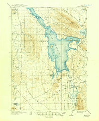
1916 Map of Henry
USGS Topo · Published 1916About this map
The newly engineered Blackfoot River Reservoir dominates this landscape in the years following its 1914 completion, held back by the Blackfoot Dam in the north. This survey, conducted between 1910 and 1914, captures a transitional period for the high-altitude ranching country of eastern Idaho. Small outposts and family-owned properties such as Perkins Ranch, Clements Ranch, and Doutts Ranch are scattered across the terrain, indicating a sparse but established pastoral economy.
Find a feature on this map
29 named features on this map. Tap any name to fly to it.
Don’t see what you’re looking for? This feature index may not catch every label — zoom into the map to look around manually.
Map Details
Editions of this 1916 Henry Map
2 editions found
Other maps of this area

1911 · Slug Creek
USGS Topo · 1:62,500

1914 · Henry
USGS Topo · 1:48,000

1915 · Lanes Creek
USGS Topo · 1:62,500

1917 · Portneuf
USGS Topo · 1:62,500

1917 · Cranes Flat
USGS Topo · 1:62,500

1918 · Paradise Valley
USGS Topo · 1:62,500

1932 · Irwin
USGS Topo · 1:96,000

1935 · Irwin
USGS Topo · 1:125,000

1948 · Bancroft
USGS Topo · 1:62,500

1948 · Soda Springs
USGS Topo · 1:62,500