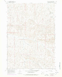
1966 Map of Henry Draw
USGS Topo · Published 1978About this map
Nowater Creek and Mud Creek carve through this section of the Bighorn Basin, defining a landscape marked by essential water management and energy infrastructure. The 1966 fieldwork, updated with 1976 aerial revisions, reveals a network of livestock reservoirs such as Jake Hampton Reservoir No 3, Hampton Reservoir No 4, and the uniquely named Pinky Reservoir.
Find a feature on this map
18 named features on this map. Tap any name to fly to it.
Don’t see what you’re looking for? This feature index may not catch every label — zoom into the map to look around manually.
Map Details
Editions of this 1966 Henry Draw Map
2 editions found
Other maps of this area

1955 · Arminto
USGS Topo · 1:250,000

1958 · Arminto
USGS Topo · 1:250,000

1960 · Coyote Hill
USGS Topo · 1:24,000

1960 · Packsaddle Creek
USGS Topo · 1:24,000

1962 · Arminto
USGS Topo · 1:250,000
1966 · Zimmerman Buttes
USGS Topo · 1:24,000
1966 · Banjo Flats West
USGS Topo · 1:24,000

1966 · Cabin Fork
USGS Topo · 1:24,000

1966 · Wagon Prong
USGS Topo · 1:24,000

1966 · Bader Draw
USGS Topo · 1:24,000