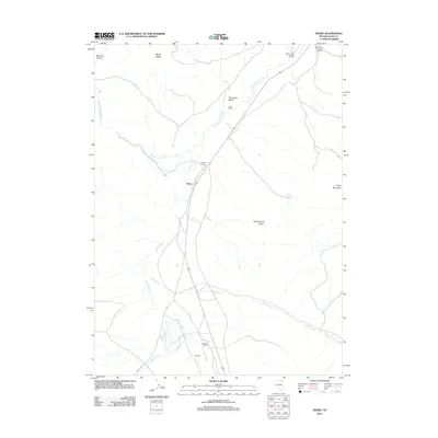
2012 Map of Henry
USGS Topo · Published 2012About this map
Henry serves as a central reference point in this northeastern Elko County landscape, where the high desert terrain is defined by a series of working ranch properties and intricate drainage systems. The settlement pattern here is sparse and distinctly agricultural, anchored by the Boies Ranch, Vineyard Ranch, and Hubbard Ranch. These properties are tied to the vital water sources of the region, including the winding Salmon Falls Creek and Knoll Creek. To the east, the elevation rises toward China Mountain, while the northern portion of the quadrangle is marked by deep topographic features like Bonanza Canyon and McDuffy Gulch. Remote access is facilitated by the Oneil Co Rd, which connects these isolated outposts across a landscape of ridges and springs, such as Sagehen Spring.
Find a feature on this map
20 named features on this map. Tap any name to fly to it.
Don’t see what you’re looking for? This feature index may not catch every label — zoom into the map to look around manually.
Map Details
Editions of this 2012 Henry Map
This is the sole edition of this map. No revisions or reprints were ever made.
Other maps of this area

1955 · Wells
USGS Topo · 1:250,000
1957 · Contact
USGS Topo · 1:62,500
1957 · Delaplain
USGS Topo · 1:62,500

1958 · Wells
USGS Topo · 1:250,000

1961 · Wells
USGS Topo · 1:250,000
1968 · Knoll Mountain
USGS Topo · 1:24,000
1968 · Hubbard Basin
USGS Topo · 1:24,000
1968 · Henry
USGS Topo · 1:24,000
1968 · Blanchard Mtn
USGS Topo · 1:24,000
1968 · Harris Canyon
USGS Topo · 1:24,000