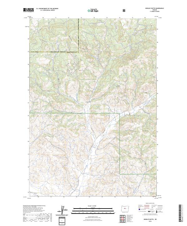
2024 Map of Hensley Butte
USGS Topo · Published 2024About this map
Ochoco National Forest defines the character of this landscape in the Ochoco Mountains. High-desert terrain and steep drainage basins are marked by prominent geological features such as Hensley Butte, Cougar Rock, and the distinctive plateaus of Little Table Mtn and Big Table. The map reveals a network of forest access routes like McKay Creek Rd and SE Turner Creek Rd that navigate the ridges between Fall Creek and McKay Creek.
Find a feature on this map
30 named features on this map. Tap any name to fly to it.
Don’t see what you’re looking for? This feature index may not catch every label — zoom into the map to look around manually.
Map Details
Editions of this 2024 Hensley Butte Map
This is the sole edition of this map. No revisions or reprints were ever made.
Other maps of this area

1948 · Ochoco Reservoir
USGS Topo · 1:62,500

1950 · Ochoco Reservoir
USGS Topo · 1:62,500

1955 · Bend
USGS Topo · 1:250,000

1957 · Bend
USGS Topo · 1:250,000

1958 · Bend
USGS Topo · 1:250,000

1962 · Huston Lake
USGS Topo · 1:24,000

1962 · Prineville
USGS Topo · 1:24,000

1962 · Prineville
USGS Topo · 1:62,500

1968 · Dutchman Creek
USGS Topo · 1:24,000
1969 · Brewer Reservoir
USGS Topo · 1:24,000