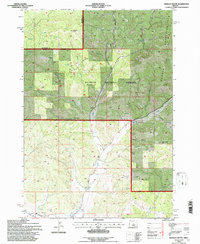
1992 Map of Hensley Butte
USGS Topo · Published 1997About this map
Ochoco National Forest dominates this section of the Ochoco Mountains during the early 1990s, revealing a landscape defined by industrial water management and timber-land topography. The southern portion of the map shows the complex irrigation infrastructure of the Main Canal, Ochoco Canal, and Diversion Canal, illustrating how water was diverted from mountain drainages like McKay Creek to support the surrounding high-desert agriculture. Prominent peaks such as Hensley Butte and Cougar Rock serve as anchor points for a network of forest roads and springs, including the curiously named Bottleneck Spring. Several quarries and Gravel Pits are noted along Gerke Road, indicating the local extraction activity used for regional road maintenance and construction projects within the forest boundaries.
Find a feature on this map
30 named features on this map. Tap any name to fly to it.
Don’t see what you’re looking for? This feature index may not catch every label — zoom into the map to look around manually.
Map Details
Editions of this 1992 Hensley Butte Map
This is the sole edition of this map. No revisions or reprints were ever made.
Other maps of this area

1948 · Ochoco Reservoir
USGS Topo · 1:62,500

1950 · Ochoco Reservoir
USGS Topo · 1:62,500

1955 · Bend
USGS Topo · 1:250,000

1957 · Bend
USGS Topo · 1:250,000

1958 · Bend
USGS Topo · 1:250,000

1962 · Huston Lake
USGS Topo · 1:24,000

1962 · Prineville
USGS Topo · 1:24,000

1962 · Prineville
USGS Topo · 1:62,500

1968 · Dutchman Creek
USGS Topo · 1:24,000
1969 · Brewer Reservoir
USGS Topo · 1:24,000