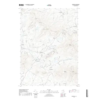
2019 Map of Hensonville
USGS Topo · Published 2019About this map
Hensonville and Windham anchor a landscape defined by the high elevations of the eastern Catskill Mountains, where small settlements are tucked between prominent peaks and valley floors. The drainage of Batavia Kill and Cornwallville Cr dictates the local geography, connecting smaller communities like Brooksburg, Maplecrest, and Cornwallville. This 2019 survey documents a dense network of mountain trails, such as the Escarpment Trail and High Peak Rd, alongside modern recreational markers including Black Bear Hideout and Twin Oaks.
Find a feature on this map
113 named features on this map. Tap any name to fly to it.
Don’t see what you’re looking for? This feature index may not catch every label — zoom into the map to look around manually.
Map Details
Editions of this 2019 Hensonville Map
This is the sole edition of this map. No revisions or reprints were ever made.
Other maps of this area

1892 · Kaaterskill
USGS Topo · 1:62,500

1893 · Kaaterskill
USGS Topo · 1:62,500

1893 · Durham
USGS Topo · 1:62,500

1894 · Kaaterskill
USGS Topo · 1:62,500

1894 · Durham
USGS Topo · 1:62,500

1899 · Kaaterskill
USGS Topo · 1:62,500

1900 · Phoenicia
USGS Topo · 1:62,500

1901 · Gilboa
USGS Topo · 1:62,500

1903 · Gilboa
USGS Topo · 1:62,500

1903 · Phoenicia
USGS Topo · 1:62,500