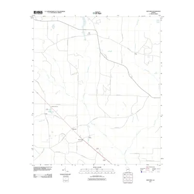
2011 Map of Hentown
USGS Topo · Published 2011About this map
Hentown, New Hope, and Cuba anchor this agricultural region of Early County, Georgia, where a network of rural county roads connects family landmarks and burial sites. The landscape is defined by the branching tributaries of Spring Creek, Wamble Creek, and the winding path of Dry Creek. Local history and genealogy are well-represented by several named cemeteries, including Liberty Hill Cemetery to the north and Dubose Cemetery and Houston Cemetery toward the southeast. The impoundment of Maddox Lake behind the Maddox Lake Dam provides a central water feature among the timber and farm plots, while Five Bridge marks a notable crossing in the northeast corner. This survey documents the persistent rural character of the Georgia Panhandle at the start of the 2010s.
Find a feature on this map
41 named features on this map. Tap any name to fly to it.
Don’t see what you’re looking for? This feature index may not catch every label — zoom into the map to look around manually.
Map Details
Editions of this 2011 Hentown Map
This is the sole edition of this map. No revisions or reprints were ever made.
Other maps of this area

1953 · Dothan
USGS Topo · 1:250,000

1954 · Dothan
USGS Topo · 1:250,000

1955 · Dothan
USGS Topo · 1:250,000

1973 · Blakely North
USGS Topo · 1:24,000

1973 · Bancroft
USGS Topo · 1:24,000

1973 · Blakely South
USGS Topo · 1:24,000

1973 · Hentown
USGS Topo · 1:24,000

1974 · Donalsonville NE
USGS Topo · 1:24,000

1974 · Damascus
USGS Topo · 1:24,000

1974 · Arlington
USGS Topo · 1:24,000