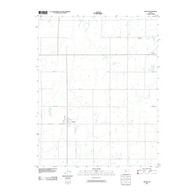
2009 Map of Hepler
USGS Topo · Published 2009About this map
Hepler serves as the central hub of this agricultural landscape in southeastern Kansas, situated at the intersection of a strictly gridded road network. The town layout is defined by streets like N Elm St, Oak St, and W Farlington St, reflecting a classic Midwestern settlement pattern. Away from the town center, the terrain is shaped by the winding paths of several waterways, including Prong Creek, Paint Creek, Owl Creek, and Walnut Creek, which contrast with the rigid lines of the section-line roads. This 2009 survey captures the persistence of small rural communities and their local landmarks, such as Saint Mary Cemetery and Hiattville Cemetery, which provide vital touchpoints for genealogical research and local history in Crawford County.
Find a feature on this map
27 named features on this map. Tap any name to fly to it.
Don’t see what you’re looking for? This feature index may not catch every label — zoom into the map to look around manually.
Map Details
Editions of this 2009 Hepler Map
This is the sole edition of this map. No revisions or reprints were ever made.
Other maps of this area

1884 · Fort Scott
USGS Topo · 1:125,000

1886 · Iola
USGS Topo · 1:125,000

1886 · Fort Scott
USGS Topo · 1:125,000

1893 · Fort Scott
USGS Topo · 1:125,000

1893 · Iola
USGS Topo · 1:125,000

1904 · Iola
USGS Topo · 1:125,000

1947 · Joplin
USGS Topo · 1:250,000

1948 · Erie
USGS Topo · 1:62,500

1948 · Girard
USGS Topo · 1:62,500

1949 · Erie
USGS Topo · 1:62,500