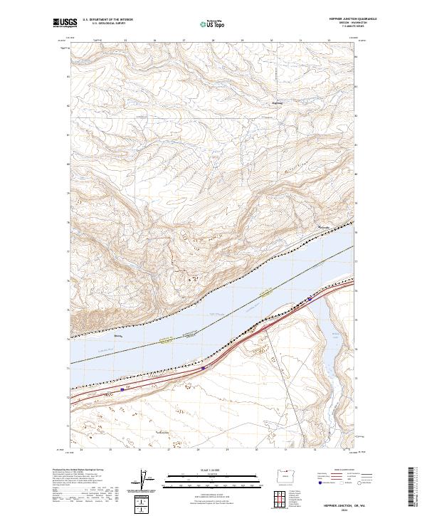
2024 Map of Heppner Junction
USGS Topo · Published 2024About this map
Lake Umatilla dominates the center of this survey, marking the state boundary between Oregon and Washington where the Columbia River carves through the landscape. The northern shore in Klickitat County rises steeply toward Alder Ridge, while the southern bank in Gilliam County transitions into the broad expanse of Hurlburt Flats. These contrasting elevations reveal a geography shaped by the river's path, with small settlements like Sixprong and McCredie situated along the northern drainages and Moona positioned near the water's edge.
Find a feature on this map
22 named features on this map. Tap any name to fly to it.
Don’t see what you’re looking for? This feature index may not catch every label — zoom into the map to look around manually.
Map Details
Editions of this 2024 Heppner Junction Map
This is the sole edition of this map. No revisions or reprints were ever made.
Other maps of this area

1906 · Blalock Island
USGS Topo · 1:125,000

1908 · Blalock Island
USGS Topo · 1:125,000

1916 · Arlington
USGS Topo · 1:125,000

1953 · Pendleton
USGS Topo · 1:250,000

1953 · The Dalles
USGS Topo · 1:250,000

1956 · The Dalles
USGS Topo · 1:250,000

1956 · Pendleton
USGS Topo · 1:250,000

1957 · The Dalles
USGS Topo · 1:250,000
1962 · Phinny Hill
USGS Topo · 1:24,000

1962 · Alderdale
USGS Topo · 1:24,000