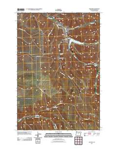
2011 Map of Heppner
USGS Topo · Published 2011About this map
Heppner serves as the focal point of this Morrow County landscape, situated at the confluence of several prominent drainages. The town's layout is defined by the Willow Creek corridor, which flows through the center of the community before being managed by the Willow Creek Dam to the south. This engineering provides for the Willow Creek Reservoir, a significant water body that alters the local hydrology. Local civic life is represented by landmarks such as the Morrow County Fairgrounds and the Heppner Post Office, while the Masonic Cemetery offers a point of interest for genealogical research.
Find a feature on this map
30 named features on this map. Tap any name to fly to it.
Don’t see what you’re looking for? This feature index may not catch every label — zoom into the map to look around manually.
Map Details
Editions of this 2011 Heppner Map
This is the sole edition of this map. No revisions or reprints were ever made.
Other maps of this area

1953 · Pendleton
USGS Topo · 1:250,000

1956 · Pendleton
USGS Topo · 1:250,000

1968 · Swaggart Buttes
USGS Topo · 1:24,000

1968 · Lexington
USGS Topo · 1:24,000

1968 · Ruggs
USGS Topo · 1:24,000

1968 · Gleason Butte
USGS Topo · 1:24,000

1968 · Heppner
USGS Topo · 1:24,000

1968 · Skinners Fork
USGS Topo · 1:24,000

1969 · Summerfield Ridge
USGS Topo · 1:24,000

1969 · Hardman
USGS Topo · 1:24,000