
2014 Map of Heppner
USGS Topo · Published 2014About this map
Heppner serves as the focal point of this high-plateau landscape in Morrow County, where the convergence of Willow Cr and Hinton Cr has shaped the town's development. The residential and commercial streets, including NW Riverside Ave and Morgan St, sit just west of the Willow Cr Reservoir, a critical water feature in this arid environment. The surrounding terrain is defined by a dense network of deep drainages, such as Dutton Canyon and Fuller Canyon, reflecting the erosive power of seasonal water across the basaltic levels.
Find a feature on this map
82 named features on this map. Tap any name to fly to it.
Don’t see what you’re looking for? This feature index may not catch every label — zoom into the map to look around manually.
Map Details
Editions of this 2014 Heppner Map
This is the sole edition of this map. No revisions or reprints were ever made.
Other maps of this area

1953 · Pendleton
USGS Topo · 1:250,000

1956 · Pendleton
USGS Topo · 1:250,000
1968 · Swaggart Buttes
USGS Topo · 1:24,000
1968 · Lexington
USGS Topo · 1:24,000
1968 · Ruggs
USGS Topo · 1:24,000
1968 · Gleason Butte
USGS Topo · 1:24,000
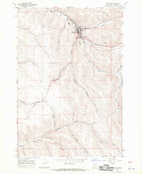
1968 · Heppner
USGS Topo · 1:24,000
1968 · Skinners Fork
USGS Topo · 1:24,000
1969 · Summerfield Ridge
USGS Topo · 1:24,000
1969 · Hardman
USGS Topo · 1:24,000