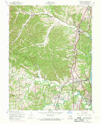
1954 Map of Herculaneum
USGS Topo · Published 1969About this map
The Mississippi River shoreline in Jefferson County serves as the industrial and transportation backbone for this 1950s landscape, revised in the late 1960s. The riverfront is dominated by the towns of Herculaneum and Pevely, where the Missouri Pacific and St Louis-San Francisco railroads parallel the water, supporting the area's growth. Inland, the terrain is defined by Joachim Creek and Sandy Creek, with the rugged Sand Ridge rising above the valleys.
Find a feature on this map
42 named features on this map. Tap any name to fly to it.
Don’t see what you’re looking for? This feature index may not catch every label — zoom into the map to look around manually.
Map Details
Editions of this 1954 Herculaneum Map
4 editions found
Other maps of this area

1901 · De Soto
USGS Topo · 1:125,000

1912 · Kimmswick
USGS Topo · 1:62,500

1915 · Crystal City
USGS Topo · 1:62,500

1916 · Kimmswick
USGS Topo · 1:62,500

1930 · De Soto NE
USGS Topo · 1:24,000

1930 · Pacific SE
USGS Topo · 1:24,000

1931 · Pacific NE
USGS Topo · 1:24,000

1948 · Kimmswick
USGS Topo · 1:62,500

1949 · Saint Louis
USGS Topo · 1:250,000

1949 · Crystal City
USGS Topo · 1:62,500