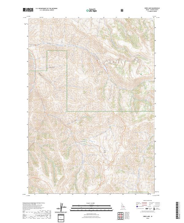
2024 Map of Herd Lake
USGS Topo · Published 2024About this map
Challis National Forest and the Jim McClure-Jerry Peak Wilderness dominate this high-elevation landscape in Custer County. The geography is defined by a dense network of drainages and trail systems, notably centering on the prominent Herd Lake and its associated Herd Lake Campsite Trail. Waterways such as Lake Creek and Mosquito Creek feed into the complex terrain of the Salmon River Mountains, while significant topographical features like Hell Canyon and Lake Basin illustrate the dramatic relief of the region. The map highlights the primitive infrastructure of the area, showing how the Herd Lake Road provides primary access to a system of backcountry routes including the Toolbox-Herd Creek Trail and Sage Brush Trail. This 2024 survey documents the modern management of federal wilderness and forest lands, preserving the names of remote geographic landmarks like Pine Gulch and Bull Gulch.
Find a feature on this map
26 named features on this map. Tap any name to fly to it.
Don’t see what you’re looking for? This feature index may not catch every label — zoom into the map to look around manually.
Map Details
Editions of this 2024 Herd Lake Map
This is the sole edition of this map. No revisions or reprints were ever made.
Other maps of this area

1895 · Hailey
USGS Topo · 1:125,000

1897 · Hailey
USGS Topo · 1:125,000

1929 · Bayhorse
USGS Topo · 1:125,000

1955 · Hailey
USGS Topo · 1:250,000

1957 · Challis
USGS Topo · 1:250,000

1959 · Hailey
USGS Topo · 1:250,000

1960 · Challis
USGS Topo · 1:250,000

1962 · Hailey
USGS Topo · 1:250,000

1963 · Challis
USGS Topo · 1:250,000
1963 · Ziegler Basin
USGS Topo · 1:24,000